Weather will be wetter, warmer – welcome or not
SEYMOUR – Expect the weather in Wisconsin and adjacent states to continue being wetter and warmer than the official recorded averages compiled since the late 1800s and to have more of the extreme events that have been more frequent in the past 10 years.
That was the gist of a message from Roy Eckberg, a meteorologist with the National Weather Service (NWS) at Green Bay, to attendees at the Outagamie County Forage Council's 2020 annual meeting and educational program. That office, which is one of five in the state, covers 22 northeast and north central counties along with adjacent bodies of water up to five miles from the shore.
While the data for past years and decades is accurate, there's no guarantee on the forecasts for weeks and months ahead, Eckberg acknowledged. He noted that the NWS issues forecasts for only the following seven days.
Eckberg pointed out that the weather forecasts for Wisconsin in January of 2020 did not prove to be accurate. Expectations that temperatures would average below normal turned out to be wrong because the jet streams that would otherwise have brought in cold air stayed more to the north, resulting in an average temperature of more than 8F degrees above normal for Green Bay.
Asked why weather forecasters on television stations in the same market predict somewhat different daily high and low temperatures and precipitation probabilities and outlooks, Eckberg said it's their choice after getting input from the NWS and other sources. In some cases, he suggested, it's a competitive tactic on the part of the stations.
Recent weather records
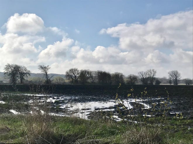
What's not in doubt, Eckberg continued, is that the 2010s decade was the wettest on record for both Wisconsin and the United States. Only 2011 and 2012 were drier than normal while three of the top five wettest years have occurred since 2016 and 2015 respectively in Wisconsin and the country, he pointed out.
What Eckberg described as “more typical of Florida” was the 67 inches of precipitation recorded at Mauston in the southwest quadrant of Wisconsin in 2019. Despite the current precipitation trend, he doesn't rule the possibility of one year of drought in the next five years.
In northeast Wisconsin during 2019, some locations had 150 percent of their normal precipitation, Eckberg reported. “That's pretty incredible.” At the Green Bay site, where the records date to 1887, the 48.63 inches of precipitation in 2019 broke the previous record set in 2018 by 9.42 inches.
The heavy precipitation is also directly linked to higher average temperatures, Eckberg remarked. That's due to how cloudiness keeps nighttime temperatures warmer, especially during the winter, he explained.
To a question about the several on-farm weather stations established in recent years, Eckberg said the NWS would welcome working with them. He noted that the Green Bay office is not collecting data from the city east to Kewaunee.
Upcoming runoff concerns
The combination of saturated soil, snow depth, and high stream and river flow is creating a concern for flooding at many places in Wisconsin, Eckberg stated. The worst scenario would be to have a rapid snow melt along with heavy rain, he observed.
Outlooks for nearby months are for somewhat lower than normal temperature and higher precipitation through the spring of 2020 while the summer and autumn months are still an unknown, Eckberg indicated. To a question about folklore beliefs on upcoming weather, he said some of them tend to be valid.
There's no long term indicator because the Pacific Ocean patterns referred to as El Nino and La Nina are neutral at the moment, Eckberg noted. El Nino supports a west to east jet stream resulting in higher temperatures in the United States while La Nina brings a more north to south jet stream and colder temperatures, he explained.
The local weather in northeast Wisconsin, especially for temperatures during May in recent years, has affected by winds from Lake Michigan, Eckberg observed. In addition, high pressure systems coming from the northeast at Hudson Bay in Canada have affected snowfall locations and volumes in Wisconsin, he added.
Extreme conditions
Regarding the extreme weather events in the state — all of them within the past decade, Eckberg reminded the attendees of the long run of temperatures in the 80s during March in 2012, the heavy mid-April snowfall in 2018, the increase in tornadoes in the past two years, and the several episodes of very high rain volumes and rainfall rates across southern Wisconsin in recent years.
In less that seven years, the Great Lakes, including Lake Michigan went from record low levels in 2013 after the drought in 2012 to record high levels in 2019, Eckberg noted. “That's unprecedented.”
Eckberg also cited the increase in the number of days in the growing season at Green Bay during the past 30 to 40 years and particularly in the past decade. Outagamie County's Extension Service crops, soils, and horticulture agent Kevin Jarek chimed in on that phenomenon.
“We're seeing things that we've never seen before,” Jarek commented. He saw live alfalfa plant shoots — not the normal state of plant dormancy during winter — under the snow during January in at least one field where the crop was seeded in 2019. Earlier, he saw snow covered forages being raked and baled.