Wisconsin's historic rain totals tell us about the upcoming winter and our 'new normal'
 Madeline Heim
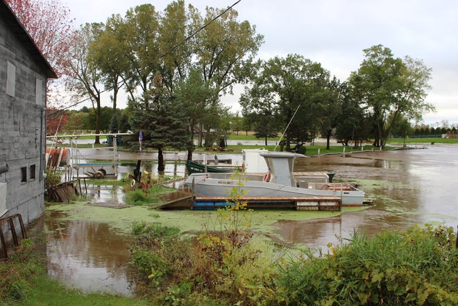
It's only October, and it's already the wettest year on record for Green Bay.
The city declared its record broken Tuesday around 3 p.m., the total reaching 39.23 inches so far this year, surpassing last year's record number of 39.21 inches.
And then the rain kept falling.
"This will establish a pretty significant record above normal," said Richard Mamrosh, a meteorologist at the National Weather Service office in Green Bay. "It’s really rare to beat your all-time record two years in a row."
In fact, the last time it happened in Green Bay was in 1890.
But where else in Wisconsin are we nearing historic totals, and why? And as every good Wisconsinite knows to ask: What does it mean for what's coming our way this winter?
RELATED: It's official: This is the wettest year in Green Bay history, even with 3 months to go
RELATED: Heavy rains close roads, cause flooding in Fond du Lac, Sheboygan counties

Which records are we breaking?
Appleton and Green Bay both had their wettest Septembers on record in 2019, with 9.16 inches and 9.37 inches, respectively.
"In general, it's been a really wet year," said Scott Berschback, meteorologist at the National Weather Service's Green Bay office. "This is the icing on the cake, the last month."
Appleton is already at its fifth-wettest year, Berschback said, and with three (often rainy or snowy) months yet to come, he expects the city will surpass that record.
Further south, Oshkosh has dodged a bullet: It's not near its record for the month or the year, Berschback said.
For Wisconsin overall, this January through September ranks among the 20 wettest on record, with an unofficial precipitation total of 30.05 inches, said Bryan Peake, a climatologist at the Midwestern Regional Climate Center. In 2018, the state recorded its 10th-wettest year.
Why is it happening?
A pattern where wet conditions hit the same areas again and again has actually been in place since last fall, Peake explained.
Especially this past summer, Peake said, weather experts have seen storms cover the same tracks, pelting regions with rain that are likely already swimming in it. That's the case for Grant County, where an MRCC station broke its rainfall record by more than six inches.
The southwest corner of the state and the northeast got hit particularly hard this month, Peake said. And, in general, southern Wisconsin tends to bear the brunt of rain showers because of long-term climate patterns that lead them through the area.
And when rain is concerned, it also depends on who gets the thunderstorms. The heaviest rain Tuesday fell near Sheboygan and missed the Fox Valley, Berschback explained. That can make for big differences in precipitation levels.

Does this mean a snowier winter?
Luckily, not necessarily. Bershback said there's no real relation between what happens in one season and what happens in the next, especially because snowfall is more often dictated by massive climate cycles like El Niño and La Niña.
The MRCC's monthly forecast predicts that there is a 50% chance that Wisconsin will see above-average precipitation for October, but anything further out is difficult to estimate, Peake said.
But they're also predicting above-average precipitation for the high plains and western Midwest in October, meaning we'll wait and see if that will drift eastward in the months that follow.

Is this our new normal?
Whether or not these back-to-back years of wetter-than-normal conditions are a result of climate change has yet to be determined, Peake said, but research does show that days with intense rainfall will increase as the planet warms.
In the MRCC's 125-year record, they are starting to see more periods of intense rainfall in recent years, he said. In the last two years, for example, nearly every "climate division," or the chunks the state of Wisconsin is split into for climate study, recorded a higher precipitation total than the "normal" calculated from 1981 to 2010.
"That data is starting to stack up," Peake said.
It could mean trouble for Wisconsin's agriculture industry as well as infrastructure, which has already taken big hits due to flooding in the last decade.
Contact Madeline Heim at 920-996-7266 or mheim@gannett.com. Follow her on Twitter at @madeline_heim.